1. What Is This Ship?
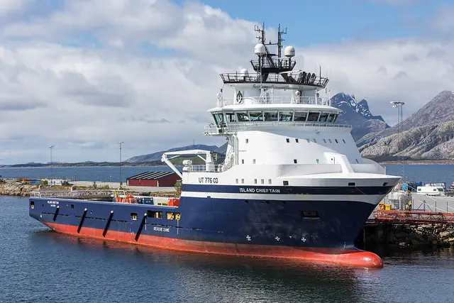
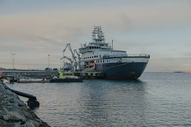
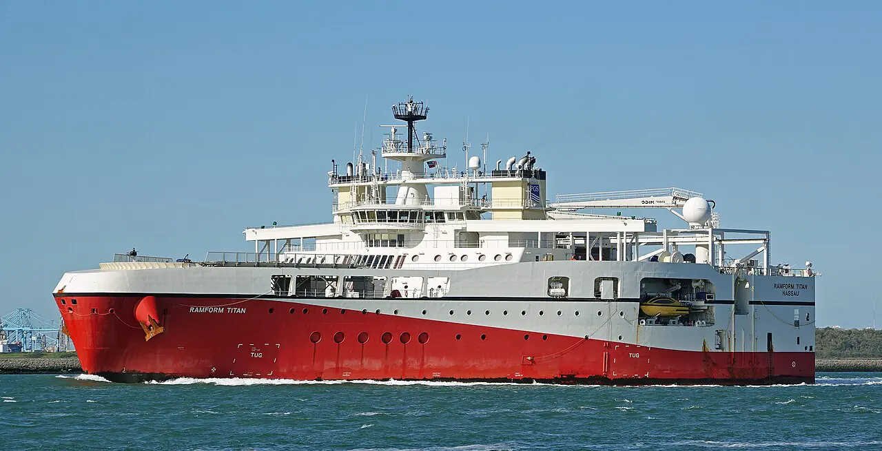
A Seismic Survey Vessel (SSV) is a highly specialized offshore vessel designed to conduct geophysical surveys to map the geological structures beneath the ocean floor. Unlike standard offshore vessels such as supply ships or platform supply vessels (PSVs), an SSV is essentially a mobile, high-tech laboratory integrated with sophisticated acoustic equipment.
The primary objective of a seismic survey is to determine the composition and structure of the sub-surface layers. This is achieved by generating controlled acoustic energy (sound waves) that penetrates the seabed and reflects off different geological strata. By measuring the time it takes for these echoes to return to specialized receivers, geophysicists can create high-resolution images of the earth’s crust.
These vessels play a pivotal role in several industries:
- Hydrocarbon Exploration: Identifying potential oil and gas reservoirs.
- Renewable Energy: Mapping the seabed for offshore wind farm foundations and cable routing.
- Scientific Research: Studying plate tectonics, oceanography, and marine biology.
- Civil Engineering: Assessing seabed stability for subsea pipelines and infrastructure.
2. Mission and Operations
The mission of a seismic survey vessel is centered on the precise acquisition of seismic data. This mission can be categorized by the complexity and scale of the survey:
2.1. 2D Seismic Acquisition
In 2D seismic surveys, the vessel tows a single seismic cable (a “streamer”) behind it. As the vessel moves along a predetermined line, the streamer records the reflected sound waves. This produces a two-dimensional cross-section of the geology along that specific line. While less detailed than 3D, 2D surveys are efficient for reconnaissance and mapping large areas at a lower cost.
2.2. 3D Seismic Acquisition
3D seismic surveys involve towing multiple parallel streamers simultaneously. This configuration allows the vessel to capture a three-dimensional volume of the sub-surface, providing far greater detail and spatial resolution. 3D data is essential for pinpointing the exact location and shape of potential hydrocarbon reservoirs or wind farm sites.
2.3. 4D Seismic (Time-Lapse Seismic)
4D seismic is the practice of repeating 3D seismic surveys over the same area at regular intervals. By comparing the 3D images over time, geophysicists can monitor changes in fluid movement (oil, gas, or water) within a reservoir or track the impact of production. This “time-lapse” approach is crucial for optimizing reservoir management and maximizing recovery.
2.4. Ocean Bottom Seismic (OBS) and Nodes (OBN)
In some environments, particularly where streamers are impractical due to depth or complex seabed terrain, specialized equipment is deployed directly onto the seafloor. This can involve towed Ocean Bottom Cables (OBC) or Ocean Bottom Nodes (OBN), which are autonomous recording units placed on the seabed by Remotely Operated Vehicles (ROVs) or specialized deployment vessels.
2.5. Operational Workflow
A typical seismic operation follows a rigorous workflow:
- Survey Planning: Defining lines, streamer configurations, and source intervals based on target geology.
- Mobilization: Deploying the seismic sources (air guns) and receivers (streamers) from the vessel.
- Acquisition: Maintaining a precise course and speed (often using Dynamic Positioning) while the equipment is towed.
- Real-time Monitoring: Surveyors and seismic technicians monitor data quality and equipment performance in real-time.
- Demobilization: Recovering the streamers and equipment after the survey area is covered.
3. Hull, Size, and Design
The design of a seismic survey vessel is dictated by the extreme requirements of its specialized equipment. The hull must provide a stable platform for sensitive acoustic measurements while possessing the power and capability to tow kilometers of heavy equipment.
3.1. Hull Form and Stability
Seismic vessels are designed with high stability and low motion characteristics. Excessive rolling or pitching can interfere with the precision of the seismic streamers and the accuracy of the positioning systems. Consequently, they often feature wide beams (breadth) and advanced stabilization systems. The hull is typically optimized to minimize noise and vibration, which could contaminate the seismic data.
3.2. Size and Dimensions
While dimensions vary based on the survey type, a modern high-end seismic vessel typically falls within the following ranges:
- Length Overall (LOA): 80 – 150 meters
- Breadth (Moulded): 20 – 35 meters
- Draft: 6 – 10 meters (depending on the operational environment)
3.3. Streamer Management and Towing Capability
One of the most defining features of an SSV is its ability to manage and tow long seismic streamers. Streamers can be several kilometers long and weigh many tonnes.
- Stern Ramps: Most vessels feature large stern ramps to facilitate the smooth deployment and recovery of streamers.
- Streamer Winches: Specialized, high-capacity winches are located on the aft deck, capable of managing the extreme tension and length of the cables.
- Towing Force: The vessel must have significant bollard pull to maintain steady movement while towing multiple streamers, which can exert hundreds of tonnes of drag.
4. Propulsion and Engines
The propulsion system of an SSV must provide both high transit speeds and exceptional maneuverability, particularly when operating in tight survey patterns or near sensitive seabed structures.
4.1. Main Engines
SSVs are typically powered by multiple large, high-output marine diesel engines. These engines are often arranged in a diesel-electric configuration, which provides greater flexibility in power distribution and helps maintain the stable electrical load required for the seismic equipment.
| Feature | Typical Specification |
|---|---|
| Engine Type | Large Marine Diesel (often Diesel-Electric) |
| Total Power Output | 15,000 – 50,000+ kW |
| Propeller Type | Controllable Pitch Propellers (CPP) |
4.2. Controllable Pitch Propellers (CPP)
Most seismic vessels utilize CPPs, which allow the crew to adjust the pitch (angle) of the propeller blades without changing the engine speed. This provides much finer control over the vessel’s speed and direction, which is critical for maintaining the precise survey lines required for 3D and 4D acquisition.
4.3. Thrusters
To assist in maneuverability and to maintain position during survey operations, SSVs are equipped with several types of thrusters:
- Bow Thrusters: Located in the bow to assist in heading control and docking.
- Azimuth Thrusters: Often integrated with the main propulsion, these can rotate 360 degrees, providing exceptional control and aiding the Dynamic Positioning (DP) system.
5. Electrical System and Power
The electrical system on a seismic survey vessel is as critical as the propulsion system. An SSV is essentially a massive power plant that must simultaneously drive heavy propulsion machinery and highly sensitive, high-precision seismic electronics.
5.1. Power Requirements and Redundancy
The power demand on an SSV is exceptionally high and variable. The primary loads are the propulsion (especially for DP operations) and the seismic equipment (compressors for air guns, streamer electronic modules, and data recording systems).
Reliability and redundancy are paramount. A loss of power during a survey can lead to the loss of expensive equipment (e.g., a streamer snagging) or a significant loss of survey time. Consequently, SSVs feature redundant power generation and distribution systems, often meeting DP2 or DP3 standards.
5.2. Power Distribution
The electrical system is typically divided into several subsystems:
- Propulsion Power: Dedicated to the main engines and thrusters.
- Auxiliary/Service Power: Powers the ship’s hotel loads, lighting, and standard navigation equipment.
- Seismic Power: A clean, highly regulated power supply dedicated to the seismic source (air gun compressors) and the receivers (streamers and recording systems). This system must be isolated from the “dirty” electrical noise produced by the propulsion system to prevent data contamination.
5.3. Generators and Shaft Generators
To ensure continuous and flexible power, SSVs use:
- Diesel Generators: Multiple large generators that can be started or stopped as demand changes.
- Shaft Generators: These generators use the main propulsion shaft to produce electrical power, which is highly efficient during transit.
6. Equipment and How It Is Used
The “heart” of the seismic survey vessel lies in its specialized acoustic and geophysical equipment. This equipment is designed to generate sound energy and then record its interaction with the earth’s layers.
6.1. Seismic Sources: Air Gun Arrays
The most common method for generating seismic energy in marine environments is the use of air guns.
- Mechanism: An air gun is a specialized device that releases a high-pressure burst of compressed air into the water. This sudden expansion creates a powerful acoustic pulse (a “shot”).
- Arrays: To achieve the necessary energy and specific frequency spectrum, air guns are deployed in large arrays. These arrays consist of many individual guns of varying sizes, linked together by harnesses, airlines, and electronic control cables.
- Compressors: The vessel must carry massive, high-capacity air compressors to maintain the high pressures required for continuous firing of the gun arrays.
6.2. Seismic Receivers: Streamers and Hydrophones
The reflected acoustic energy is detected by seismic streamers.
- Streamers: These are long, buoyant cables (often several kilometers in length) towed behind the vessel. They act as the “ears” of the ship.
- Hydrophones: Inside each streamer are hundreds or thousands of hydrophones. A hydrophone is a pressure-sensitive device that converts the acoustic pressure of the reflected sound wave into an electrical signal.
- Electronic Modules: Integrated into the streamer at regular intervals, these modules digitize the analog signals from the hydrophones and transmit the data back to the vessel.
Table: Typical Streamer Components
| Component | Function |
|---|---|
| Hydrophone | Converts acoustic pressure to electrical signal. |
| Electronic Module | Digitizes and transmits seismic data. |
| Stress Member | Provides structural strength (Steel or Kevlar). |
| Electrical System | Supplies power and data telemetry. |
| Skin | Protective outer layer housing all components. |
6.3. Dynamic Positioning (DP) Systems
Maintaining a precise, steady course and speed while towing kilometers of streamers is nearly impossible with traditional steering. Dynamic Positioning (DP) systems use a combination of GPS (GNSS), inertial sensors, and thrusters to automatically hold the vessel in a specific position and heading.
- DP2 and DP3: These are industry standards for redundancy. A DP2 system can maintain position even if one component (e.g., a generator or thruster) fails. A DP3 system provides even higher levels of protection, often involving physical separation of redundant systems to survive more severe incidents.
6.4. Positioning and Acoustic Systems
To ensure that both the vessel and the towed equipment (guns and streamers) are accurately located in 3D space, SSVs use:
- DGNSS (Differential Global Navigation Satellite System): Provides highly accurate vessel positioning.
- USBL (Ultra-Short Baseline): An acoustic positioning system used to track subsea equipment like tail buoys and gun floats.
- Inertial Navigation Systems (INS): Provide highly accurate heading and position data, especially when GPS signals are temporarily lost.
7. Navigation, Communications, and Safety
While specialized, the SSV must still adhere to all standard maritime requirements for navigation, communication, and safety. However, its navigation and communication needs are significantly enhanced by its survey mission.
7.1. Navigation Equipment
Advanced navigation is critical for survey accuracy.
- GNSS/DGNSS: For high-precision vessel positioning.
- ECDIS (Electronic Chart Display and Information System): For electronic charting and route planning.
- Radar: For collision avoidance and situational awareness.
- Inertial Navigation Systems (INS): To provide precise heading and position data during survey operations.
7.2. Communications
- Satellite Communications (VSAT): Crucial for long-range operations, providing high-bandwidth data for transmitting survey results and supporting crew welfare.
- Radio Communications (VHF/HF): For standard maritime communications and coordination with other vessels.
- AIS (Automatic Identification System): For vessel identification and collision avoidance.
7.3. Safety Systems
Safety on an SSV is paramount due to the high-pressure equipment (air guns), heavy towing gear (streamers), and the complex nature of offshore operations.
- Life-Saving Appliances: Lifeboats, liferafts, and survival suits.
- Firefighting Systems: Specialized systems for engine rooms and accommodation.
- DP Alarm Systems: To alert the crew if the vessel’s ability to maintain position is compromised.
- Emergency Shutdown (ESD) Systems: For the high-pressure air compressors and seismic equipment.
8. Crew and Organization
A seismic survey vessel requires a highly specialized and diverse crew to manage both the maritime operations and the complex scientific mission. The crew is typically divided into two main groups: the Marine Crew and the Survey Crew.
8.1. Marine Crew (Deck and Engine)
The marine crew is responsible for the safe operation and maintenance of the vessel.
- Master (Captain): Overall command of the vessel and safety of all personnel.
- Chief Officer: Manages deck operations, including streamer deployment/recovery and cargo.
- Chief Engineer: Responsible for the vessel’s engines, electrical systems, and technical maintenance.
- Deck Officers (Mates): Assist in navigation and watchkeeping.
- Engineers/Electricians: Maintain the complex propulsion and electrical systems.
- Ratings (AB, OS): Support deck and engine room operations.
8.2. Survey Crew (Scientific and Technical)
The survey crew is responsible for the successful execution of the seismic mission.
- Survey Manager: Oversees the entire survey operation and ensures data quality.
- Surveyors: Responsible for the precise navigation and positioning of the vessel and all towed equipment.
- Seismic Technicians: Manage the seismic source (air guns) and the receivers (streamers).
- Data Engineers/Geophysicists: Monitor the real-time acquisition of seismic data and perform initial processing/quality control.
9. Certificates and Training Requirements
Operating a seismic survey vessel requires specialized certifications for both the maritime and technical aspects of the job.
9.1. Maritime Certifications
All marine crew must hold standard maritime certifications as required by the STCW (Standards of Training, Certification and Watchkeeping for Seafarers) convention. This includes:
- Basic Safety Training.
- Advanced Firefighting.
- Proficiency in Survival Craft.
- Medical First Aid.
9.2. Specialized Offshore Certifications
Due to the offshore nature of the work, personnel must also hold:
- BOSIET (Basic Offshore Safety Induction and Emergency Training): Required for anyone working in offshore environments.
- DP Certificate of Competency: Essential for officers responsible for operating the Dynamic Positioning systems.
9.3. Technical/Seismic Training
The survey crew requires specialized training in:
- Seismic acquisition technology and equipment.
- Data management and real-time processing software.
- Use of high-precision positioning and acoustic systems.
10. Regulations, Class, and Inspections
Seismic survey vessels are subject to a strict regime of international regulations and industry standards to ensure safety, environmental protection, and operational reliability.
10.1. International Maritime Organization (IMO) Regulations
SSVs must comply with all applicable IMO conventions, including:
- SOLAS (Safety of Life at Sea): Standards for ship construction, equipment, and operation.
- MARPOL (International Convention for the Prevention of Pollution from Ships): Regulations for preventing oil, sewage, and air pollution.
- COLREG (International Regulations for Preventing Collisions at Sea): The “rules of the road” for maritime navigation.
10.2. Classification Societies
To verify that they are built and maintained to the highest standards, SSVs are “classed” by recognized societies such as:
- DNV (Det Norske Veritas)
- ABS (American Bureau of Shipping)
- Lloyd’s Register (LR)
- Bureau Veritas (BV)
Classification involves regular inspections and audits of the hull, machinery, electrical systems, and safety equipment.
10.3. Industry Standards
Beyond legal requirements, SSVs must often adhere to strict industry-specific standards set by major oil and gas companies (the “clients”) regarding data quality, safety protocols, and environmental management.
11. Notable Shipyards, Operators, and Example Vessels
The seismic survey vessel market is dominated by a few specialized shipyards and major global survey companies.
11.1. Notable Shipyards
Shipyards that specialize in high-end offshore survey vessels include:
- Ulstein Group (Norway): Known for advanced vessel designs (e.g., the X-BOW®).
- Vard (Norway): A leading designer and builder of specialized offshore vessels.
11.2. Major Operators
The global seismic survey market is led by companies such as:
- PGS (Petroleum Geo-Services): A world leader in seismic data and technology.
- TGS: A major provider of seismic data and interpretation services.
- SLB (formerly Schlumberger): A dominant player in integrated oilfield services, including seismic.
- CGG: A global leader in geophysical, mapping, and subsurface characterization.
11.3. Example Vessels
| Vessel Name | Operator | Key Feature |
|---|---|---|
| Oceanic Sirius | (Various/Charter) | High-end Ulstein design; capable of large 3D/4D surveys. |
| Seismic Vessel (Generic) | N/A | Typically 70-120m, equipped with 10-20 streamer winches. |
12. Environment and Future Outlook
The seismic survey industry is undergoing significant changes driven by technological innovation and increasing environmental scrutiny.
12.1. Environmental Impact and Mitigation
A major environmental concern regarding seismic surveys is the impact of acoustic noise on marine life (e.g., whales and dolphins).
- Mitigation Strategies: Use of “soft starts” (gradually increasing air gun pressure), marine mammal observers (MMOs), and acoustic deterrent devices to minimize harm.
- Regulatory Pressure: Increasing regulations regarding noise pollution in sensitive habitats.
12.2. Future Trends
Several key trends are shaping the future of seismic acquisition:
- Autonomous Seismic Vessels (ASVs): The development of unmanned or semi-autonomous vessels to reduce costs and improve safety.
- Ocean Bottom Nodes (OBN): A shift toward more precise, seabed-based acquisition for complex environments.
- Multi-client Surveys: Companies acquiring data that can be sold to multiple clients, increasing efficiency.
- Integration with Digital Twins: Using seismic data to create real-time digital models of reservoirs and subsea infrastructure.
13. Facts, Records, and Common Misconceptions
13.1. Common Misconceptions
- “They are just big boats”: As noted, they are highly specialized, mobile scientific laboratories with much more complex systems than standard offshore vessels.
- “Seismic surveys are always loud and harmful”: While noise is a concern, the industry has developed sophisticated mitigation techniques and is constantly innovating to reduce the acoustic footprint.
13.2. Key Facts
- Extreme Lengths: A single seismic streamer can be up to 12 kilometers long.
- Precision Matters: The difference between a successful survey and a failure is often measured in centimeters of positioning accuracy.
14. Glossary
- 4D Seismic: Time-lapse seismic surveys used to monitor reservoir changes.
- Air Gun: A device that releases compressed air to create acoustic energy.
- Azimuth Thruster: A propulsion unit that can rotate 360 degrees.
- Controllable Pitch Propeller (CPP): A propeller where the blade angle can be adjusted.
- Dynamic Positioning (DP): An automated system for maintaining vessel position.
- Hydrophone: A device that converts sound pressure into electrical signals.
- OBS (Ocean Bottom Seismic): Seismic acquisition using sensors on the seabed.
- Streamer: A long cable towed by a vessel containing hydrophones.
- USBL (Ultra-Short Baseline): An acoustic positioning system for subsea equipment.